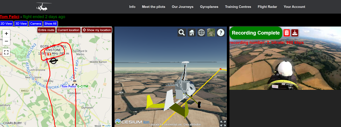
On a phone screen, a red line crawls across a map. A friend on the ground can see where I am; a few taps away is the cockpit view, the flight timer, and now even a phone-based artificial horizon. In the latest hardware incarnation, the aircraft can transmit its own position, video and radio audio without the pilot touching a phone at all. It is a long way from where the project started in 2019: a simple website built to help a small flying community stay connected. When COVID restrictions arrived the following year, that period became the catalyst for developing the Flight Recorder App.
GyroPilots.org never set out to become an avionics platform. It grew because one small irritation kept leading to another useful question. How do we share a memorable trip without everyone having to build a blog? How can friends know where pilots are without adding another cockpit task? How can an instructor follow a student solo flight? How can friends or family know that a flight has finished safely — or, more importantly, that the tracking has gone unexpectedly quiet? And once live video became possible, how could it be added without turning every departure into an IT support session?
Each answer pushed the project a little further: from community website, to Flight Recorder App, to training tool, to guardian system, to live audiovisual platform. Then practical generative AI changed the development loop itself. Ideas from pilots that once would have sat on the development list for months can now move from a conversation to a working feature almost in real time. Through all of that, one rule has remained constant: make it simple enough that the technology disappears into the flight.
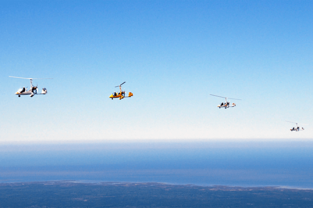
The flight path: 2019–2026
It began with stories, not telemetry
The first GyroPilots idea was deliberately modest. The project began in 2019 as a digital clubhouse for gyroplane pilots and their friends, centred on stories, news and community connections. Members could publish stories from their journeys, add news and discover other people in the gyro community.
That original emphasis is still visible today in “Our Journeys”: pilots can tell the story of where they have flown and attach the route itself to the story. The site has since grown into pilot profiles, school and aircraft directories, news, live tracking, streaming and — much later — a marketplace. But the first problem was not navigation or commerce. It was memory and connection: capturing the routes, photographs and anecdotes that normally get told over coffee after the propeller stops.
Once that existed, the next question was irresistible. If the website could show where we had been after a flight, why could it not show where we were during the flight?
Keep the navigation app in front
During the long COVID-lockdown months of 2020, there was suddenly far more spare time than usual — largely because there was nowhere much to go and, crucially for a pilot, nowhere to fly. That unexpected pause created the opportunity to move beyond the website and build the first Flight Recorder App. It came with a deceptively important design decision: The App must not demand the pilot’s attention. Dedicated aviation navigation software already owns the prime position in the cockpit. The Flight Recorder App had to sit quietly behind it.
So tracking was designed to continue in the background even with the screen locked or another app in the foreground. GPS points could be stored when mobile coverage disappeared and synchronised later when a signal returned. In practical terms, a pilot could start the Flight Recorder App, switch straight back to SkyDemon or another navigation app, and forget about the App until landing.
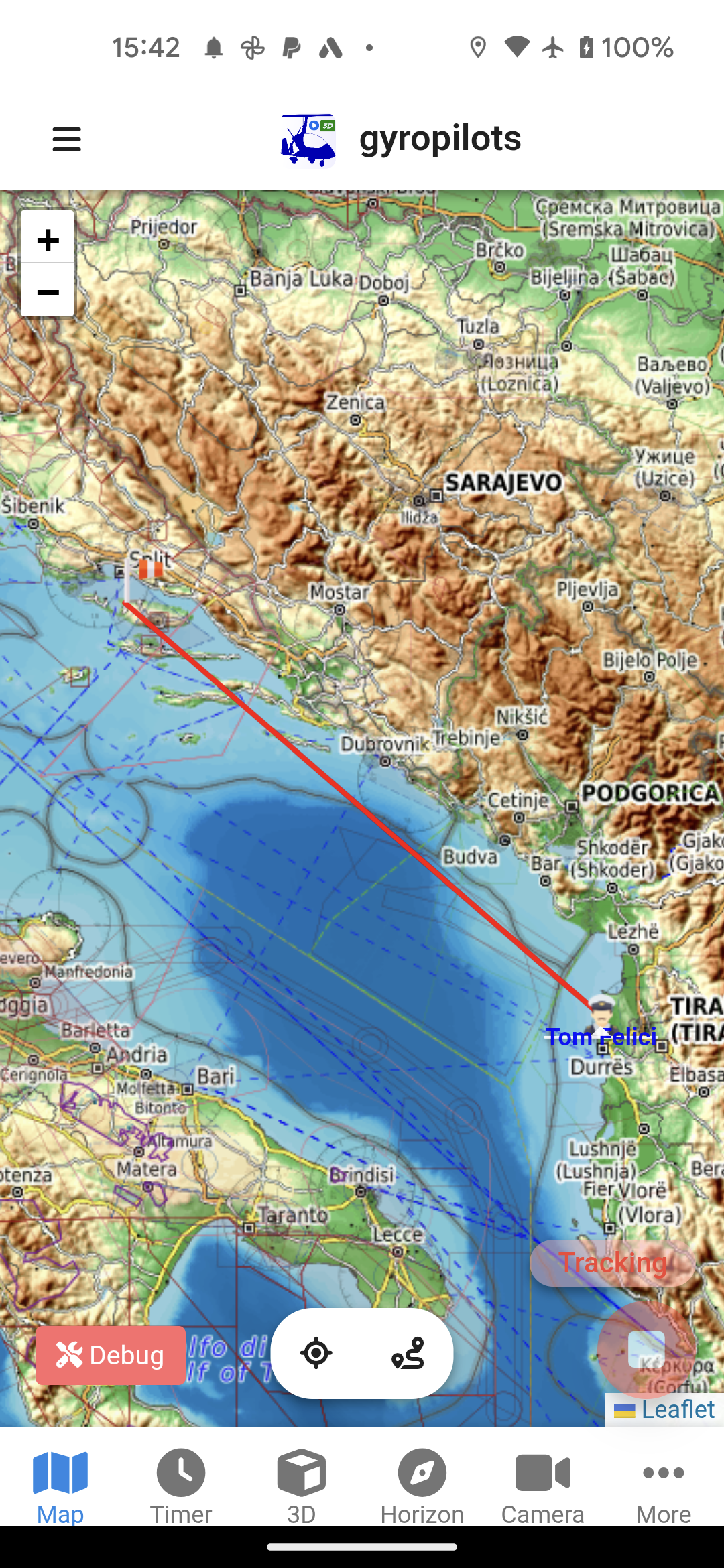
For friends on the ground, that changed the experience too. Instead of waiting for a “landed safely” message, they could watch the route form live on the GyroPilots flight radar. Groups of pilots could use it to coordinate fly-ins. And for instructors, a much more interesting use emerged: they could follow the progress of a student’s solo flight without being in the aircraft.
When the Flight Recorder App met the logbook
In 2021, the Flight Recorder App was connected to external flight-management systems. That changed what the App could be. Live tracking is useful; integrating the Flight Recorder App into the workflow of a flying school starts to make it infrastructure.
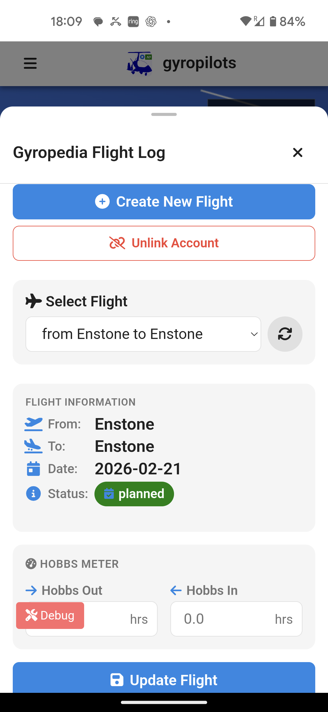
The App now integrates with Gyropedia, allowing a flight to be created, started, stopped and updated from within the App, with the recorded three-dimensional track available afterwards. The integration helped the system find its way into training environments, including Highland Aviation — which in 2021 became the UK’s first CAA Approved Training Organisation for gyroplanes.
The same “Start Flight” action could now do more than draw a line on a map. It could trigger a flight record and a training trail and, later, a camera stream. It became clear how much leverage there was in simplicity: one deliberate cockpit action could safely start several background processes.
Why background operation mattered
- The pilot keeps the primary navigation application visible.
- GPS points survive temporary loss of mobile data and synchronise afterwards.
- A recorded route can feed both community stories and formal flight-management records.
- An instructor can use live tracking as an additional way to follow a student solo.
The moment silence became a signal
Live tracking is reassuring while it is alive. The uncomfortable question is what happens when it suddenly stops. In 2022 the first “guardian” notification system was added. Friends and family could receive an email automatically when tracking started and again when the flight ended.
The more important part was the watchdog. If the App stopped sending location updates unexpectedly during the flight, the system could warn the people following it. An unmoving icon might be nothing more than poor reception or a flat phone battery — but it might not. The aim was for the system itself to notice that silence rather than relying on somebody to stare at a map all afternoon.
Then video made everything difficult again
The first live-video experiment was wonderfully simple on paper. Some action cameras already supported RTMP, a widely used video-streaming protocol for sending live video over the internet. Give the camera an RTMP endpoint — the internet address it should send the live video to — connect it to mobile data, and the App could put a live cockpit picture next to the moving map.
In the air, it was clunky. Consumer cameras behave well on stable Wi-Fi; a cross-country flight moves between cell towers and through weak-signal areas. A dropped connection could kill a stream, and the setup before flight could become fiddly. The feature was exciting to watch but was starting to violate the original rule: it demanded too much attention.
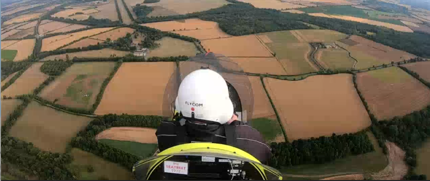
That drove development towards dedicated encoder hardware that could reconnect automatically and be controlled through the App. Clean audio directly from the aircraft radio/intercom was also essential rather than the roar of engine and wind picked up by an ordinary action-camera microphone. That line of development eventually matured into the RPI Streamer.
Months of spare-time coding collapsed into hours
By 2026, AI had changed not just what could be built, but the speed at which pilot feedback could become working software. The App was rewritten from scratch with a cleaner interface and a modern technical base. Features that would once have cost me weeks or months of evenings could suddenly be explored, coded, tested and refined in a fraction of the time.
The biggest change is the feedback loop. A pilot can suggest something over a coffee, at a fly-in or in a message, and a serious working version can sometimes follow almost immediately. For a free spare-time community project, that is transformational. It means useful ideas no longer have to lose out simply because they are too expensive in development time.
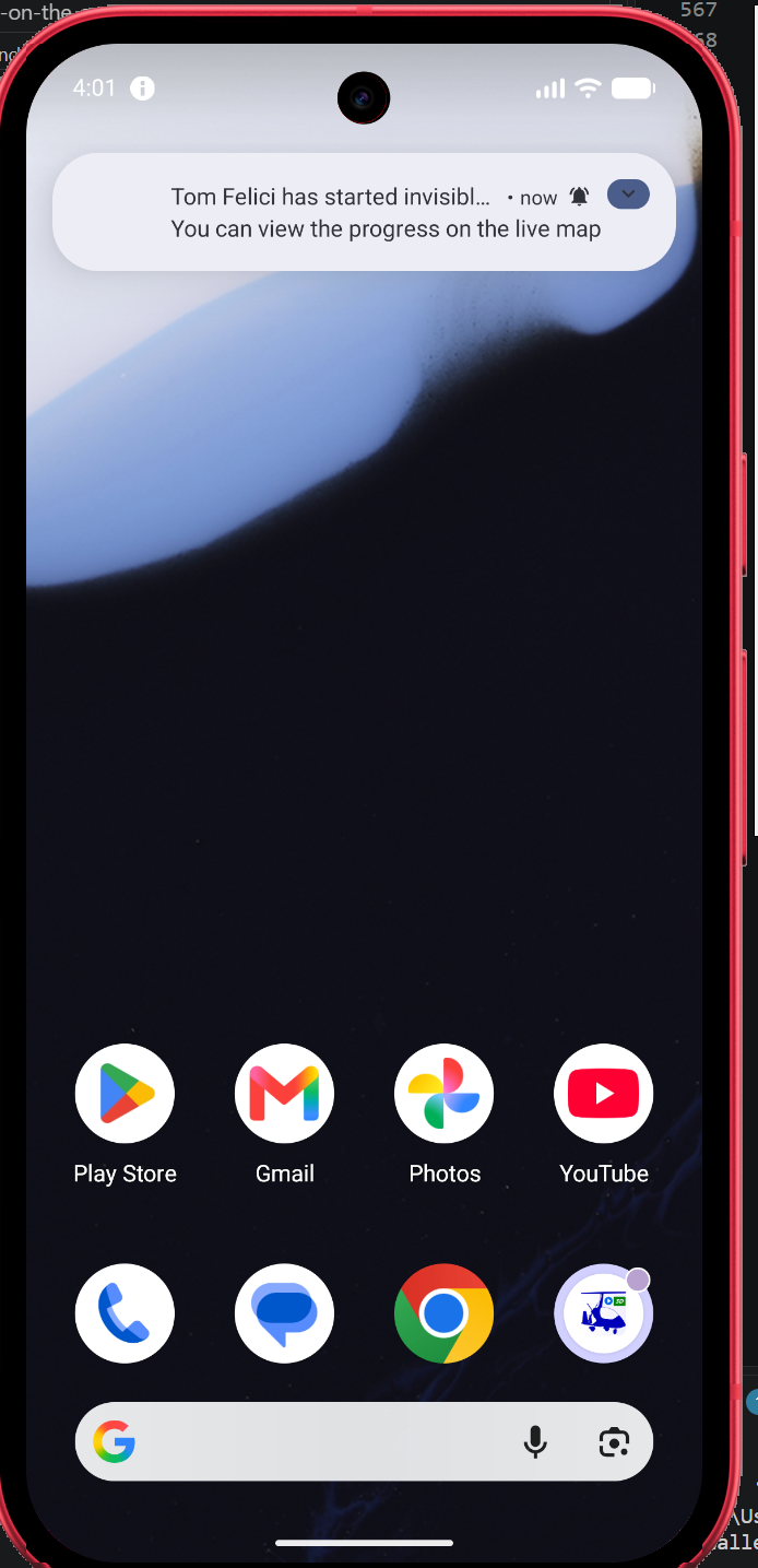
The push notification deserves special emphasis because, for me, it is a major safety improvement. The original guardian emails worked, but they still depended on a friend remembering to keep an eye on their inbox. Now the phone itself pings when the flight starts, when it ends, or when the safety watchdog detects that updates have stopped unexpectedly. The follower no longer has to monitor the system continuously; the App actively gets their attention.
The Swedish ping
A Swedish fixed-wing pilot, Tomas, reached out after discovering the App. He and his friends became valuable testers, helping uncover bugs and, just as importantly, highlighting pain points in the interface that led to a number of usability improvements.
Tomas also pushed for proper phone push notifications. The weakness of email alerts was simple: the person following a flight still had to remember to check them. A direct phone ping at departure, arrival or an unexpected loss of tracking makes the guardian feature far more immediate and much harder to miss.
Swedish mountain flying is a particularly good example of why that matters. Under the current rules, when an aircraft flies within Sweden’s designated mountainous area and the flight extends more than 25 NM from the starting point, the pilot must either file a flight plan or leave details of the planned flight with a nominated person or organisation responsible for following it, and report the landing as soon as possible afterwards. For pilots such as Tomas and his friends, an active phone alert therefore fits naturally into a flight-following responsibility that already exists in law.
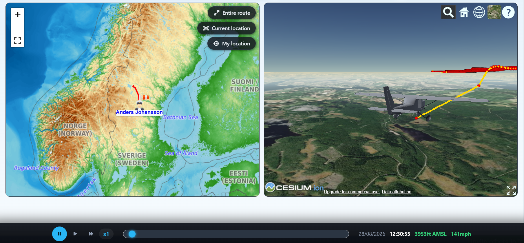
A few years earlier I would probably have agreed that it was a good idea and then quietly put it on the “someday” list. Reliable cross-device push notifications are a significant technical job, and on a free project I simply could not justify weeks of spare-time development. With AI helping me through the architecture, implementation and debugging, I had the feature working in barely two days. That is what I mean when I say pilot feedback can now become software almost in real time.
AI at both ends of the feedback loop
There was another AI layer to the collaboration. After testing the App in Sweden, Tomas could describe his experience freely in Swedish — what worked, what was confusing and what might be improved — then use AI to organise, translate and sharpen those thoughts into clear English feedback. On the development side, AI helped turn selected ideas into working changes. The loop became remarkably fast: real-world flying → human observations → AI-assisted communication → human judgement → AI-assisted development → another flight test. The important decisions remained human; AI simply removed much of the friction between an idea and a useful result.
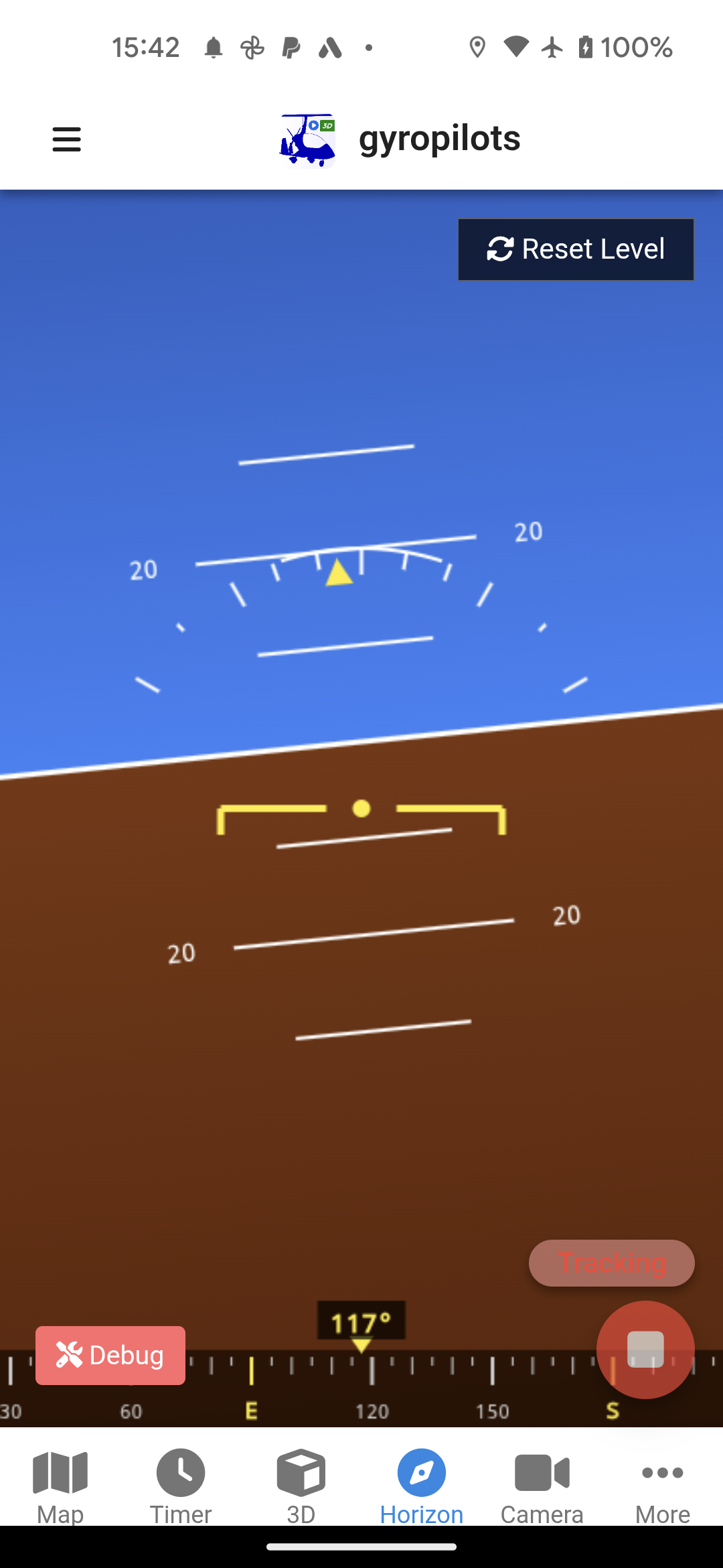
The artificial horizon is another example. The phone already contains the motion sensors; the difficult part is turning their raw orientation data into a stable, understandable pitch-and-roll display. AI helped work through the maths as well as the code. A feature that once looked like a substantial research project became practical enough to include in the rewrite.
The marketplace born at a camping fly-in
The marketplace came even more directly from a conversation. At a camping fly-in I was talking with gyro pilots Steve and Chris. They pointed out that, although AFORS is the big general-aviation marketplace in the UK and carries gyro listings, there was no marketplace built specifically around the gyroplane community itself.
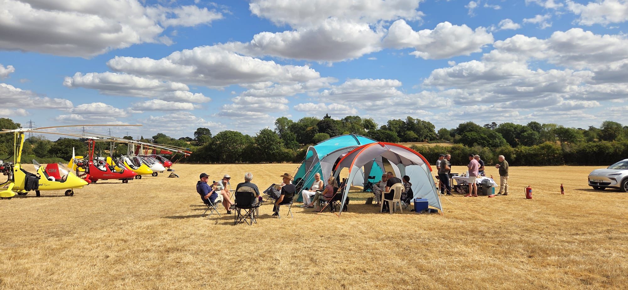
Before AI, that conversation would almost certainly have become a note in the backlog: useful idea, but not useful enough to justify another sizeable chunk of unpaid development. This time I went home and built it. By the end of an afternoon, GyroPilots had its own marketplace.
And because the website was already an international community rather than a UK-only club, I did not have to stop at the original problem Steve and Chris had identified. The marketplace is available to members around the world for advertising gyroplanes and aviation equipment. That feature was not part of the original 2019 site; it is one of the clearest examples of what became possible once the cost of turning an idea into working software collapsed.
The current App brings together Public, Invisible and Private flight-visibility modes, take-off and landing notifications, the safety watchdog, live mapping, background operation, flight statistics, Gyropedia integration, onboard camera viewing, the artificial horizon and push alerts. The website’s current line — “Your flight. Tracked. Shared. Free.” — still describes the thing I care about most: all of this should add connection and reassurance without adding cockpit workload.
The black box that is not quite a black box
The new RPI Streamer is the hardware answer to many of the lessons from those first video experiments. It is a compact Linux/Raspberry-Pi-based computer with an integrated uninterruptible power system designed for the awkward electrical life of a light aircraft. Aircraft voltage can sag during engine start or fluctuate in operation, so the Streamer is designed to keep recording and transmitting through those interruptions rather than simply rebooting at the worst possible moment.
Connected to a camera and the aircraft radio, it captures cockpit video and clean communications audio. It can stream over a phone’s 4G hotspot and begin automatically when the pilot starts tracking in the App. At the same time it records the flight locally. If mobile coverage falls apart en route, the complete onboard recording survives and can later replace the incomplete online version through the Streamer Uploader.
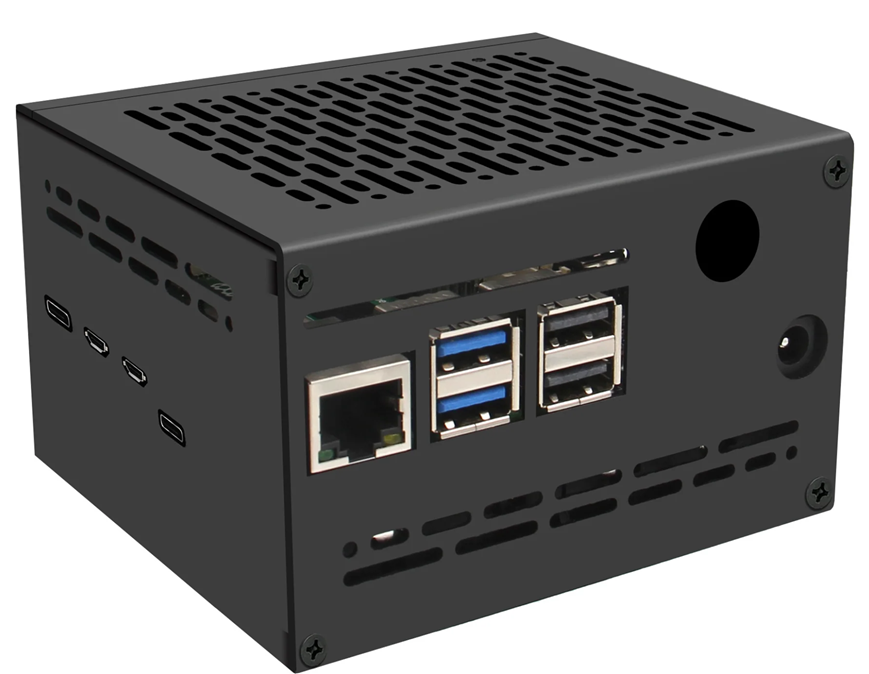
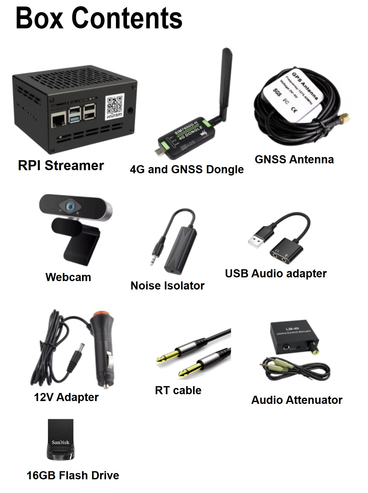
The current hardware supports adaptive streaming, local MP4/H.264 recording, cameras up to 1080p, aircraft-radio line audio, system diagnostics and remote control. Two battery-backed variants were built, the compact RPI-S205 and the larger-capacity RPI-S206. Those specifications are really just answers to practical flying lessons: networks fail, aircraft power is messy, cockpit audio is hostile, and anything that needs repeated manual setup will eventually be forgotten.
The next step: remove the phone
The newest version takes the “one click” principle to its logical extreme: no click at all.
The RPI Automated Tracking System adds its own GNSS receiver and 4G connectivity. It can wake when aircraft power is applied or movement is detected, acquire position, connect to the mobile network, begin tracking, stream video and aviation audio, and then detect arrival and shut itself down. A web-based management layer supports configuration, diagnostics and flight history remotely.
It is described as an “install and forget” solution because, to me, it closes the loop that began in 2020. The original App moved itself into the background so the navigation program could stay in front. The automated hardware moves the entire tracking and video system out of the pilot’s interaction loop.
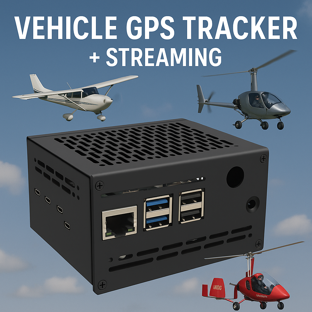
For a private owner, that means fewer things to remember. For a flying school or shared aircraft, the implications are larger. The Automated Tracking System can belong to the aircraft rather than to an individual pilot’s phone. Every flight can be captured consistently; an instructor can follow a solo; video and radio audio can support debriefing; the system can continue on battery power through a supply interruption; and configuration can be managed without dismantling the installation.
What the project now brings together
- Community: pilot profiles, journey stories, news, schools and the later AI-enabled marketplace.
- Tracking: live GPS route sharing with Public, Invisible and Private visibility modes, background operation and offline synchronisation.
- Training workflow: external flight-management integration and flight replay.
- Guardian features: start/stop and “tracking has gone silent” alerts, now delivered as direct push notifications as well as the earlier email system.
- Flight interface: timer, statistics and a phone-sensor artificial horizon.
- Live media: cockpit video plus aircraft-radio audio, with local recording as backup.
- Autonomous hardware: integrated GNSS, 4G, power management and remote administration.
It keeps coming back to one question
GyroPilots did not begin as an avionics product. It began as a way for pilots to tell one another where they had been. But every stage since then has come back to essentially the same question: how much of the flying experience can be shared without making the pilot work harder?
In 2019 the answer was a story posted after landing. In 2020 it was a live dot on a map. In 2022 that dot learned to call for attention when it went quiet. In 2023 it gained eyes and ears. In 2026 AI changed the speed at which the project could react to the community: a Swedish pilot’s request could become a push alert in two days; a conversation with Steve and Chris at a camping fly-in could become a worldwide marketplace in an afternoon.
Now the hardware itself is trying to disappear from the pilot’s workload. That feels like the right destination for a project built around a one-button idea. The more capable the system becomes, the less the pilot should have to notice it.
Sources & further reading
This feature is told in the first person from the project creator’s development timeline and recollections. Current capabilities and supporting factual context were checked against the following live pages in August 2026.
- GyroPilots.org — main community site (community, stories, schools, news, marketplace and Flight Recorder App promotion).
- GyroPilots Help & FAQ (background tracking, offline sync, Gyropedia integration, notifications and the evolution of live streaming).
- GyroPilots Flight Recorder App (current app features: live GPS, push alerts, safety watchdog, artificial horizon, camera streaming and Gyropedia integration).
- GyroPilots Flight Stories (community journey archive).
- GyroPilots Marketplace (current member classifieds).
- RPI Streamer — Professional Aviation Streaming Device (video/audio capture, local recording, UPS power, uploader and hardware variants).
- RPI Automated Tracking System (integrated 4G/GNSS, automatic start/stop, remote management and “install & forget” architecture).
- Highland Aviation — About Us (2021 status as the first UK Approved Training Organisation for gyroplanes).
- AIP Sweden — mountainous-area flying (background information on flight-following provisions in Sweden’s designated mountainous area).
- Swedish Transport Agency TSFS 2020:59, consolidated through TSFS 2026:46 (current 25 NM mountain-area flight-following and post-landing reporting provisions).
- AFORS (the broad UK general-aviation marketplace referenced in the fly-in anecdote).